−The Loess Plateau, China
When science meets centuries of lived consequence
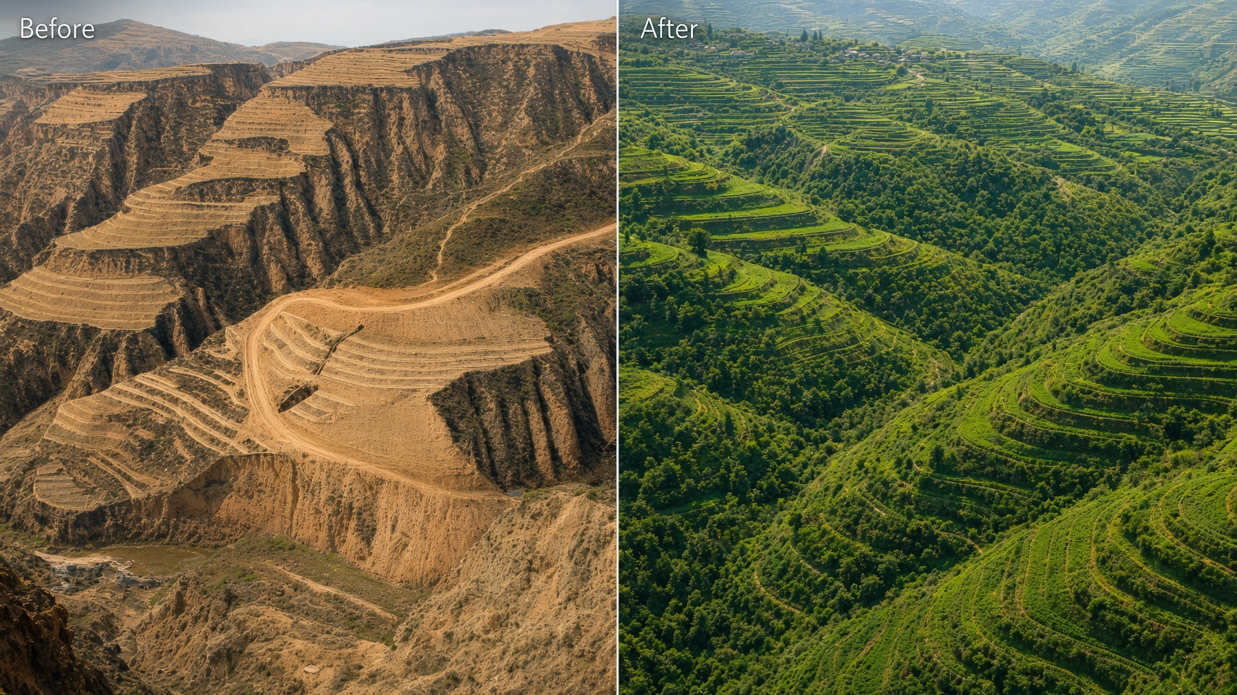
The Loess Plateau Watershed Rehabilitation Project was one of the largest landscape restoration efforts of the modern era. Launched in 1994 with funding from the World Bank and the Chinese government, it targeted 15,600 km² of severely eroded land in one of China’s poorest regions, a vast stretch of the Yellow River system where farming had existed for millennia, yet the land could no longer reliably feed the people who lived on it.
The core problem was water. The soil itself was fertile, but it sat on steep slopes. Centuries of cultivation, population pressure, and the loss of trees had left the land unable to hold what little rain fell. In a semi-arid region with highly variable rainfall, once the soil could no longer retain water, crops failed and hunger followed.
Two solutions illustrate how modern tools and ancient practice worked together.
The first was terracing, an old method of flattening hillsides so water slows down and soaks in rather than racing away. Science added precise instrumentation and sensors that allowed farmers and technicians to monitor conditions in real time and adjust before damage became irreversible.
The second was integrated watershed management: treating the entire water system as one connected whole rather than isolated plots. Drones and satellite imagery accelerated the ability to track progress and respond to rapid environmental change. Age-old sediment retention dams were also rebuilt and expanded to stop soil from washing off the slopes.
Where the land was still fertile enough, it was terraced. Where it was not, trees were planted. Production was concentrated on the flatter, more productive ground in ways consistent with agroforestry principles.
By the time the main phases of the project ended in 2005, large areas of degraded land had been rehabilitated. Vegetation cover increased significantly, soil erosion dropped, and many farming households saw higher production and incomes. The physical results, terracing, tree planting, and sediment control, are well documented and widely accepted.
The strongest claims about lifting millions of people out of poverty, however, rest mainly on World Bank and Chinese government data. The World Bank’s own independent evaluators later rated the overall outcome as satisfactory rather than highly satisfactory, and noted that the evidence on income and poverty reduction was weaker and harder to attribute cleanly to the project alone.
The core problem was water. The soil itself was fertile, but it sat on steep slopes. Centuries of cultivation, population pressure, and the loss of trees had left the land unable to hold what little rain fell. In a semi-arid region with highly variable rainfall, once the soil could no longer retain water, crops failed and hunger followed.
Two solutions illustrate how modern tools and ancient practice worked together.
The first was terracing, an old method of flattening hillsides so water slows down and soaks in rather than racing away. Science added precise instrumentation and sensors that allowed farmers and technicians to monitor conditions in real time and adjust before damage became irreversible.
The second was integrated watershed management: treating the entire water system as one connected whole rather than isolated plots. Drones and satellite imagery accelerated the ability to track progress and respond to rapid environmental change. Age-old sediment retention dams were also rebuilt and expanded to stop soil from washing off the slopes.
Where the land was still fertile enough, it was terraced. Where it was not, trees were planted. Production was concentrated on the flatter, more productive ground in ways consistent with agroforestry principles.
By the time the main phases of the project ended in 2005, large areas of degraded land had been rehabilitated. Vegetation cover increased significantly, soil erosion dropped, and many farming households saw higher production and incomes. The physical results, terracing, tree planting, and sediment control, are well documented and widely accepted.
The strongest claims about lifting millions of people out of poverty, however, rest mainly on World Bank and Chinese government data. The World Bank’s own independent evaluators later rated the overall outcome as satisfactory rather than highly satisfactory, and noted that the evidence on income and poverty reduction was weaker and harder to attribute cleanly to the project alone.
−Vi Agroforestry, Kenya and Tanzania
Returning to an older intelligence
For most of human history, small-scale farmers did not plant a single crop. They grew a mix of food crops and trees on the same land. The trees provided firewood, fruit, fodder for animals, and leaf litter that fed the soil. This diversified system helped families survive droughts, pests, and poor seasons. It was practical intelligence built over centuries.
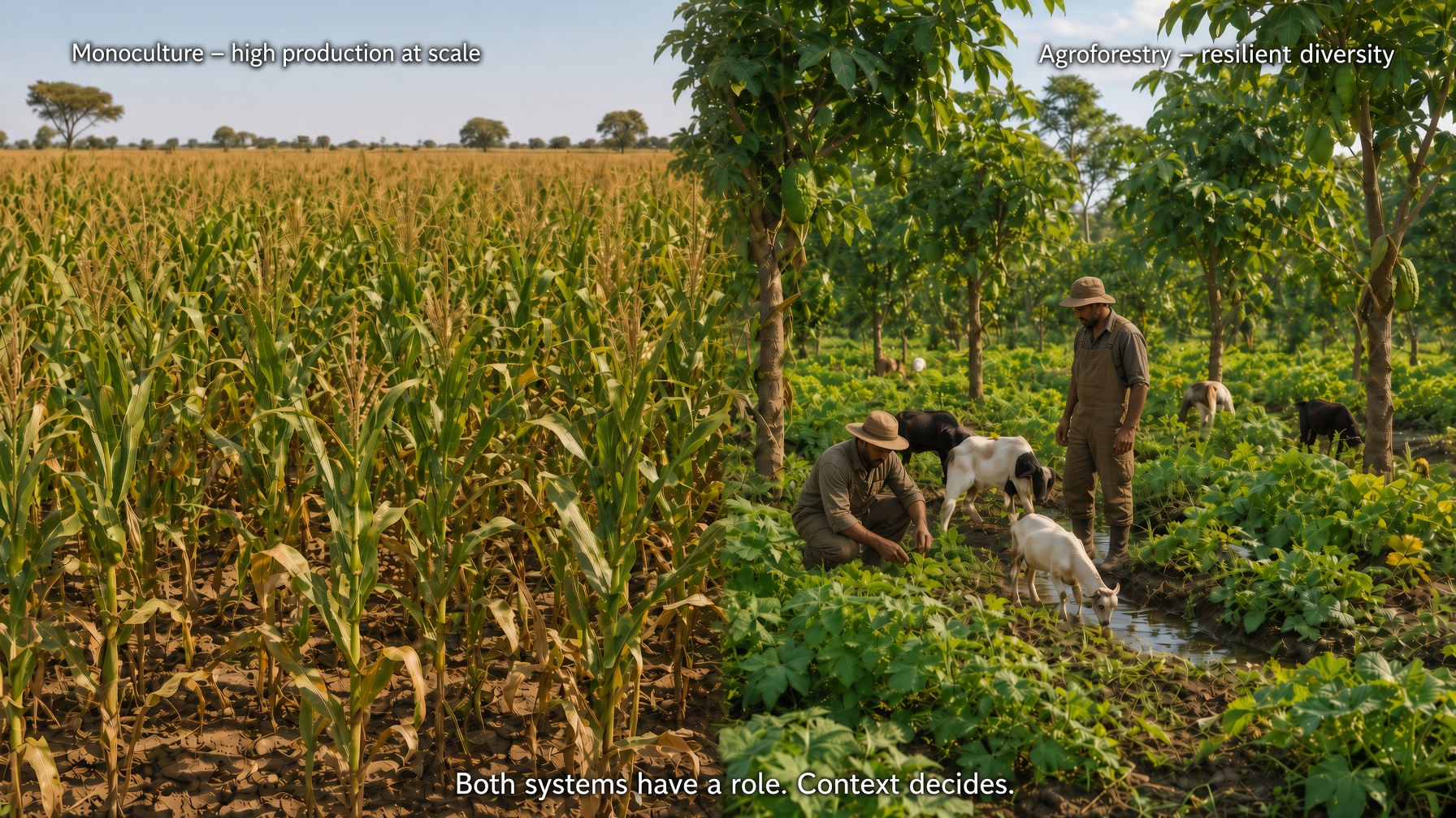
In the 20th century, scientists gave this practice a formal name, agroforestry, and began refining it. At the same time, industrial agriculture pushed hard in the opposite direction: grow one crop at maximum scale. Monoculture, especially of crops like maize, dramatically increased total food production in many regions and reduced hunger. But it also brought heavy fertilizer use, greater vulnerability to climate shocks, and environmental damage. What worked in some places was promoted as the universal solution everywhere.
Today the balance is shifting again. Diversification is once more recognized as essential for resilience. In the Lake Victoria region of Kenya and Tanzania, the Vi Agroforestry project has been working since 1983 to help farmers recover this older knowledge. Because many communities had moved away from mixed systems under pressure to modernize, the project trains farmers to reintegrate trees into their fields.
The results on the ground are practical. Farmers gain firewood without walking long distances, harvest fruit, feed livestock from the same land, and improve soil fertility as leaves fall and decompose. The approach is deliberately local and farmer-led rather than a massive top-down scheme that tries to apply one formula across an entire region.
This does not mean large monoculture farms should disappear. Both systems have a role. The real question is context: which approach fits the land, the climate, and the people who must live with the consequences. Evidence from Vi Agroforestry and similar programs shows measurable benefits in yields, fuelwood access, soil health, and household resilience in many cases, though the scale and consistency of those gains still vary by location and remain the subject of ongoing study.
In the 20th century, scientists gave this practice a formal name, agroforestry, and began refining it. At the same time, industrial agriculture pushed hard in the opposite direction: grow one crop at maximum scale. Monoculture, especially of crops like maize, dramatically increased total food production in many regions and reduced hunger. But it also brought heavy fertilizer use, greater vulnerability to climate shocks, and environmental damage. What worked in some places was promoted as the universal solution everywhere.
Today the balance is shifting again. Diversification is once more recognized as essential for resilience. In the Lake Victoria region of Kenya and Tanzania, the Vi Agroforestry project has been working since 1983 to help farmers recover this older knowledge. Because many communities had moved away from mixed systems under pressure to modernize, the project trains farmers to reintegrate trees into their fields.
The results on the ground are practical. Farmers gain firewood without walking long distances, harvest fruit, feed livestock from the same land, and improve soil fertility as leaves fall and decompose. The approach is deliberately local and farmer-led rather than a massive top-down scheme that tries to apply one formula across an entire region.
This does not mean large monoculture farms should disappear. Both systems have a role. The real question is context: which approach fits the land, the climate, and the people who must live with the consequences. Evidence from Vi Agroforestry and similar programs shows measurable benefits in yields, fuelwood access, soil health, and household resilience in many cases, though the scale and consistency of those gains still vary by location and remain the subject of ongoing study.
−The Great Green Wall, Africa
Ambition on a continental scale
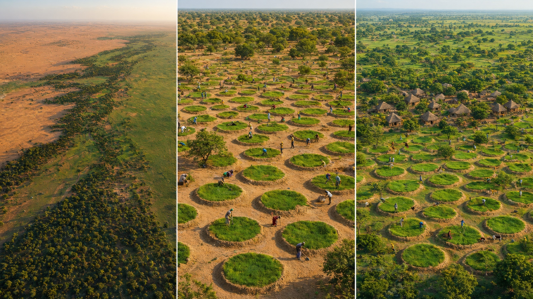
Africa’s Great Green Wall is one of the most ambitious restoration projects ever attempted. Launched in 2007 by the African Union, it aims to create a vast mosaic of restored landscapes stretching roughly 7,775–8,000 km across the Sahel, from Senegal in the west to Djibouti in the east. The original vision described a band 15 km wide, though the actual work varies by country and terrain, sometimes reaching much greater widths.
The goal is straightforward but enormous: slow desertification, restore degraded land, create jobs, strengthen food security, and build climate resilience for communities living on the edge of the Sahara. Tree planting is central, but the project also uses a wide range of local techniques, water harvesting, agroforestry, grazing management, and community-led land restoration, adapted to very different climates, soils, and cultures across more than a dozen countries.
One of its smarter design features is decentralization. Rather than trying to run everything from a single central authority, the initiative hands significant control to national governments and local communities. This recognizes a basic reality: no single plan can fit the full length of the Sahel.
Progress has been real but uneven. Senegal, Ethiopia, and Nigeria have recorded more visible gains. Many other participating countries have moved more slowly, held back by funding gaps, insecurity, political instability, and the sheer difficulty of keeping young trees alive in harsh conditions. The official target remains 2030: restore 100 million hectares of degraded land and create 10 million jobs. Current results fall well short of that pace. Billions have been pledged, including major commitments after the 2021 One Planet Summit, yet far less has reached the ground in consistent, well-monitored form.
Like most projects of this scale, the Great Green Wall is behind schedule. The gap between vision and delivery once again shows why large initiatives need smaller, locally rooted efforts working alongside them. Both are required. Grand plans can set direction and mobilize resources. Local judgment is what keeps the work alive when the money, the weather, or the politics shift.
The goal is straightforward but enormous: slow desertification, restore degraded land, create jobs, strengthen food security, and build climate resilience for communities living on the edge of the Sahara. Tree planting is central, but the project also uses a wide range of local techniques, water harvesting, agroforestry, grazing management, and community-led land restoration, adapted to very different climates, soils, and cultures across more than a dozen countries.
One of its smarter design features is decentralization. Rather than trying to run everything from a single central authority, the initiative hands significant control to national governments and local communities. This recognizes a basic reality: no single plan can fit the full length of the Sahel.
Progress has been real but uneven. Senegal, Ethiopia, and Nigeria have recorded more visible gains. Many other participating countries have moved more slowly, held back by funding gaps, insecurity, political instability, and the sheer difficulty of keeping young trees alive in harsh conditions. The official target remains 2030: restore 100 million hectares of degraded land and create 10 million jobs. Current results fall well short of that pace. Billions have been pledged, including major commitments after the 2021 One Planet Summit, yet far less has reached the ground in consistent, well-monitored form.
Like most projects of this scale, the Great Green Wall is behind schedule. The gap between vision and delivery once again shows why large initiatives need smaller, locally rooted efforts working alongside them. Both are required. Grand plans can set direction and mobilize resources. Local judgment is what keeps the work alive when the money, the weather, or the politics shift.
−System of Rice Intensification, Madagascar
Observation under real constraint
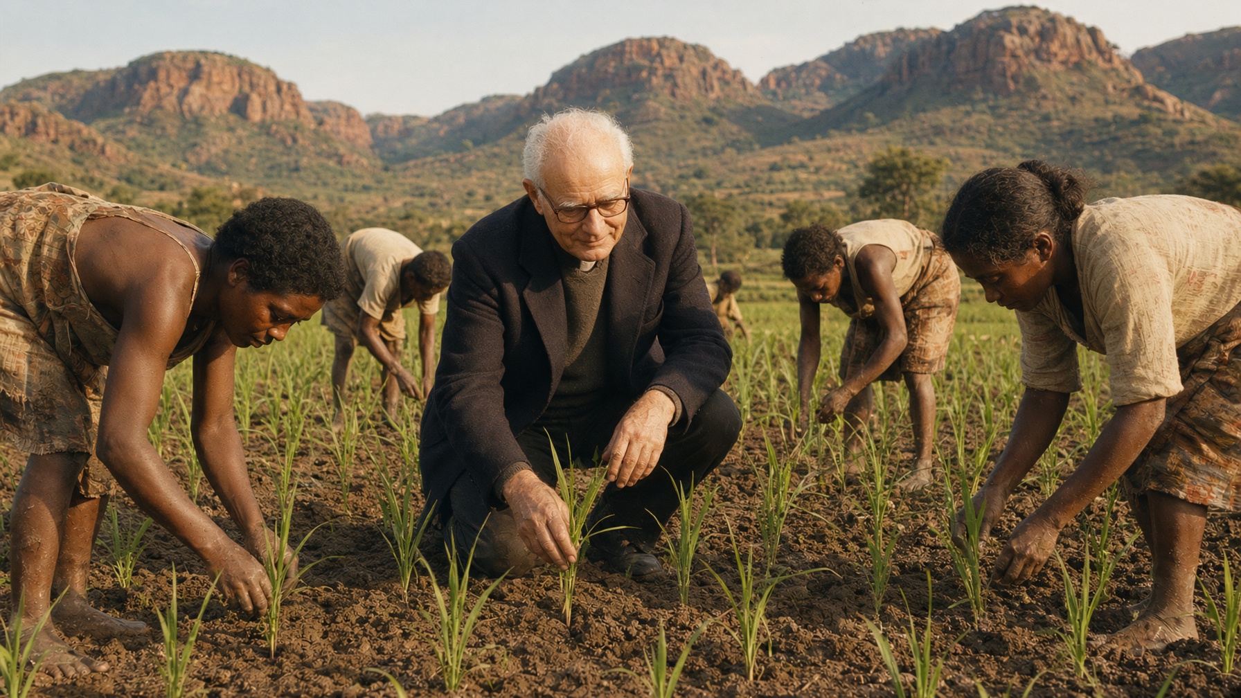
This unknown French Jesuit priest in Madagascar changed how millions grow rice, with no formal scientific training.
In the 1980s, Father Henri de Laulanié simply watched. He observed how fragile young rice plants actually behave in the mud. Then he flipped every traditional assumption: plant younger seedlings, space them wider, use far less water, and manage the fields by alternating wet and dry periods instead of keeping them flooded.
The result was higher yields, lower costs, and greater resilience for some of the poorest smallholder farmers. Studies later showed yield increases of around 50% for those who adopted the method. By the time national statistics were recorded, roughly a quarter of Madagascar’s rice farmers were using some form of the System of Rice Intensification (SRI).
It is not effortless. The method demands more careful labor, transplanting young seedlings by hand and constantly adjusting water levels. But it was born from direct observation under real constraint, not from a research station or committee.
No lab. No grand theory. Just quiet attention to what the plants and the land were already revealing.
Real adaptability is forged where consequence is immediate, not in a safe office, but in places like a farm.
Think you’re tougher or smarter than a farmer?
Under pressure, who adapts faster?
In the 1980s, Father Henri de Laulanié simply watched. He observed how fragile young rice plants actually behave in the mud. Then he flipped every traditional assumption: plant younger seedlings, space them wider, use far less water, and manage the fields by alternating wet and dry periods instead of keeping them flooded.
The result was higher yields, lower costs, and greater resilience for some of the poorest smallholder farmers. Studies later showed yield increases of around 50% for those who adopted the method. By the time national statistics were recorded, roughly a quarter of Madagascar’s rice farmers were using some form of the System of Rice Intensification (SRI).
It is not effortless. The method demands more careful labor, transplanting young seedlings by hand and constantly adjusting water levels. But it was born from direct observation under real constraint, not from a research station or committee.
No lab. No grand theory. Just quiet attention to what the plants and the land were already revealing.
Real adaptability is forged where consequence is immediate, not in a safe office, but in places like a farm.
Think you’re tougher or smarter than a farmer?
Under pressure, who adapts faster?